

Continental Divide Trail is a Tree with Many Branches
Continental Divide Trail is a Tree with Many Branches
Continental Divide Trail is a Tree with Many Branches, when you look closely, the Continental Divide Trail is much like a family tree. You know…those genealogical trees with many “branches” that stick out in all directions, showing how the “family” began and continued to grow over time. The CDT, in fact, grows the same way: as it runs through five states in this great country, each “branch” – each facet of the trail – offers up some of the most stunning beauty America has to offer.
Part of a three-pronged family, it is called the “most rugged of America’s triple crown of long trails.” The Continental Divide journey outdoes its’ brothers, the Pacific Crest Trail and the Appalachian Trail. Running approximately 3,100 miles from Canada to Mexico, the journey takes true adventure-seekers through Montana, Idaho, Wyoming, Colorado, and New Mexico, allowing people to enjoy and explore elevations that range from 4,000 feet to 14,000 along the way.
Called “thru-hikers,” there are those who attempt to hike the Continental Divide Trail in a single season. And because of their successes, explorations, and the historical sites found along the way – books have been written, movies made, and organizations have sprung up over the years dedicated to helping others grow even more passionate about the incredible path. A combination of dedicated trails and small roads have literally captured the imagination of many, and provided those who want that thrill of the challenge a chance to do something truly extraordinary.
Only about two hundred people a year attempt to hike the entire trail, taking about six months to complete it. When you break down the trail by state, each one has their own history and challenges to boast about. In New Mexico, the CDT is about 700 miles long and, because of the fact that portions of the trail offer a limited water supply, volunteer groups continuously place water caches in the form of plastic gallon jugs along strategic points, in order to make it easier for the hiker.
The most recognized point where a hiker begins (or ends) is known as Crazy Cook Monument. However, seeing as that this is extremely remote, with no lodging or services available, a town called Columbus is where most who wish to hike or bike the CDT start out. Columbus sits three miles away from the International Port of Entry at Palomas, Mexico, and is one of the first (or last) National Historic Landmarks that you will visit. It is here, in 1916, Pancho Villa and his “Villistas” famously invaded, and the town offers two museums and a state park commemorating Villa’s raid and the expedition led by General “Blackjack” Pershing who tried to capture Pancho, but failed.
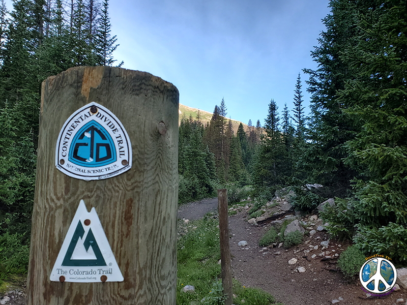
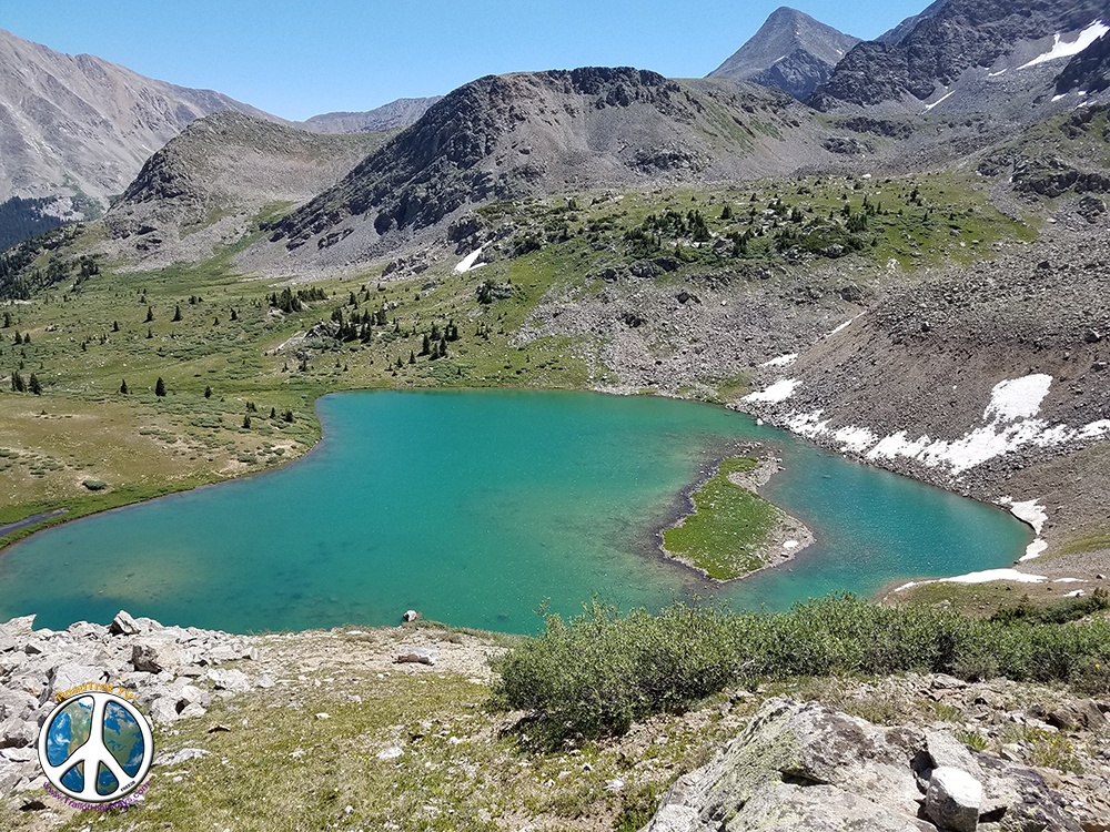
When heading through Colorado, the CDT curves its way through some of the highest and most wild landscapes imaginable, such as the San Juan Mountains in southern Colorado and the Sawatch Range in the central part of the state. Well marked for hikers in most areas, the CDT runs concurrent with the Colorado Trail for approximately 200 miles, and for 650 miles total, the hiker is quite literally soaking up the beauty of the higher altitudes and the nature and animal families running about. Offering many “side trips” along the way, all can have access to those 14,000-foot peaks.
When looking at all five states, Wyoming is the one where explorers of the CDT will find the most diverse sections as they hike. Examples of this are the vast range-land called the Great Divide Basin, and in the north, the mountain terrain of the Wind River Range. The highlight, of course, is seeing the most recorded site of all – Yellowstone National Park. It is here that the CDT goes through Yellowstone’s southern back country and brings you to Old Faithful before you exit into Idaho.
For a couple of hundred miles in Idaho, the CDT follows the Continental Divide with Idaho on one side and Montana on the other, before finally diverting east through the Anaconda Mountain Range. After this facet of the trail, hikers find themselves headed to the gorgeous town of Butte, Montana.
When it comes to Montana, the CDT was absolutely made for people who love to hike through mountain ranges on a daily basis. Heading towards Butte and then on to Glacier National Park, explorers take in the Lewis and Clark National Forest and two National Wilderness areas.
The Continental Divide Trail is also a beacon of light for the U.S. of A. It is a site that shows wonderful things are still out there being protected by wonderful people. The CDTC (Continental Divide Trail Coalition) is a national non-profit working with the U.S. Forest Service, National Park Service, and the Bureau of Land Management. Founded in 2012, this group of volunteers who were passionate about keeping the CDT unharmed set this up and continue to work with others to complete, promote and protect the Continental Divide National Scenic Trail.
It is because of their hard work – taking care of something so future generations can enjoy it – that once again shows how the beloved trail is a tree with many branches that will continue to thrive.
Chalk Pass Hike 1-1: Click Here
As a company, as individuals and a group, we are strong supporters of public land and can’t stress enough how everyone needs to get involved with a local conservation in your area and do all we can to save our “Wilderness Areas, Monuments, and other Public Lands”.
Don’t Let Our Government become very reckless with Nature and Our Public Lands! Support Your Local Conservation Organizations!